No edit summary |
m (format) |
||
| (4 intermediate revisions by 2 users not shown) | |||
| Line 1: | Line 1: | ||
<includeonly>{{#if:{{{filename|}}}|{{# | <includeonly>{{#if: {{{filename|}}} | | ||
{{#set: Has location map = File:{{{filename}}};{{{caption|}}};{{filepath:{{{filename}}}}}}}<!---->[[File:{{{filename}}}|thumb|{{{customsize|275px}}}|right|{{{caption}}}]] | |||
|Please specify a file name for this map. | |||
}}</includeonly><noinclude> | |||
<noinclude> | |||
{{Documentation}} | {{Documentation}} | ||
[[Category:Location templates]] | |||
</noinclude> | </noinclude> | ||
Latest revision as of 05:08, 20 June 2024
Documentation (for the above template, sometimes hidden or invisible)
Description
This template is used to display individual map(s) of a world/area on its article.
| Parameter | Description | Type | Status | |
|---|---|---|---|---|
| Filename | filename | The map's file name, inclusive of file type.
| String | required |
| Caption | caption | A caption describing the map. | String | suggested |
| Custom size | customsize | A custom size for displaying the map, measured in pixels.
| String | optional |
Syntax
{{LocationMap
| filename = [e.g. "Example.png"]
| caption =
| customsize = [e.g. 20px, 270px if left blank]
}}
Note: most maps should use both filename and caption. customsize is optional.
Sample
{{LocationMap
| filename = Forestpier mapwork.png
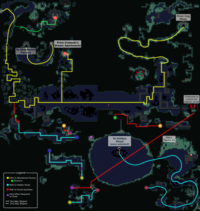
| caption = Annotated map of the area
| customsize = 200px
}}
Visit Template:LocationMap/doc to edit this text! (How does this work?)

